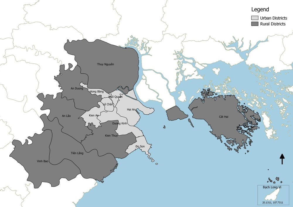
Hai Phong is located at the mouth of the Cấm River along the northern extremity of the Red River Delta Basin. Given its location and surrounding topography, the city has a history of flooding going back centuries. Natural disaster risk is a potentially critical obstacle to green growth in Hai Phong. In 1881, the city was almost destroyed by a typhoon that killed 300 000 residents. An extensive system of dikes and canals has been built to contain the Cấm River and other rivers in the area to irrigate the rich rice-growing delta. Thus, for centuries flood control has been an integral part of the Red River Delta and Hai Phong’s public policy.
Floods are becoming increasingly frequent and more destructive as population growth and large tracts of natural hinterland are developed. Among cities with populations greater than one million, Hai Phong is among the top 10 coastal cities with highest population exposure to coastal floods in the world, with 794 000 persons being exposed as of 2007, while it is projected that more than 4.7 million will be exposed by the 2070s, under a scenario taking into account climate, subsidence and socio-economic changes. While Hai Phong is not among the top 20 cities with the most exposed assets, it is nevertheless among the top 15 cities with the highest proportional increase (from the current situation) in exposed assets by the 2070s, under the same scenario (Hanson, et al., 2011).
Hai Phong lies directly along one of the most frequent paths for Pacific typhoons that originate in and around the Philippines and reach the Asian mainland through the Gulf of Tonkin. Severe tropical cyclones are expected to take place every 5 or 10 years in Hai Phong, and the annual total number of storms is on the rise (City of Hai Phong, 2015). In 2012, the Son Tinh typhoon caused Hai Phong a loss of property estimated at VND 1 000 billion (around USD 330 million, PPP), and the destruction or damage of many businesses and infrastructure, including 63 wrecked ships and 8 collapsed marine management stations. This typhoon was the most severely devastating disaster in Hai Phong over the past ten years but the city also suffered from similar disasters in 2005, 2008, 2009, 2010 and 2011, which bore impacts on the port facilities. For example, the 2008 storm overturned 202 containers and destroyed 2 ship cranes (City of Hai Phong, 2015).
Hinterland areas that once retained rainwater run-off and allowed it to infiltrate into the soil and groundwater have been urbanised. Downstream of the city of Hai Phong, drainage systems have not been sufficiently developed to deal with the increasing run-off water. During the process of rapid urbanisation, many vulnerable settlements and households have been established in flood-prone areas in the city, such as along drainage canals, creeks, rivers, or in low-lying areas. Moreover, many natural coastal defences such as mangrove forests and estuary wetlands have disappeared, mainly due to activities of local communities such as shrimp aquaculture.
The presence in the port of harmful substances, materials and critical facilities such as oil, hazardous waste in containers, sludge, poses an additional risk factor linked to floods and storms. The intensity of climatic events and the lack of proper treatment and handling of such materials create a risk of environmental contamination during floods and storms.

